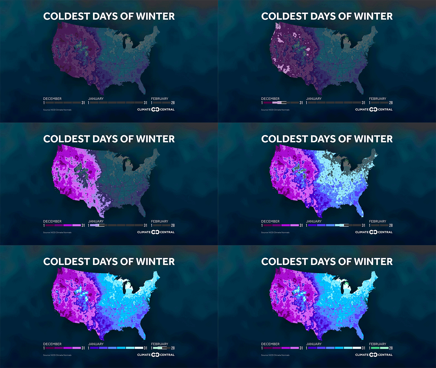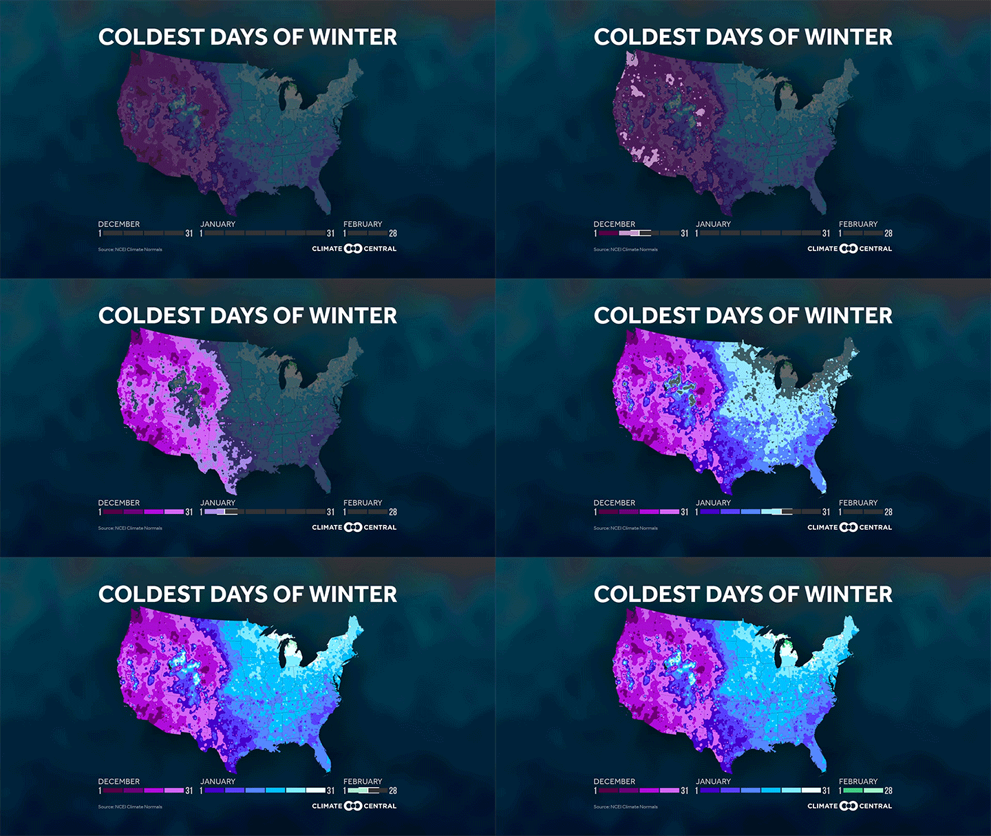


Although we just passed the midpoint of meteorological winter, that does not mean it is the coldest time of year in all areas of the country. Differences in topography, latitude and proximity to large bodies of water all play roles in the climate of individual areas.
Much of the West usually has its coldest days early in the winter season. In the Southeast, the cold peak often comes a little later — in early January — whereas in the Northeast, the coldest days do not typically come until mid to late January. According to NOAA, the areas that record their coldest days late in the season, such as the Great Lakes and high elevations of the Rockies, tend to be the areas that average more snow on the ground during winter. Snow is a great reflector of incoming solar energy, so it blocks the ground from absorbing energy and warming up.
Methodology: This map is derived from the 1981–2010 U.S. Climate Normals — NCEI’s 30-year averages of climatological variables, including the average low temperature for every day. To find the coldest day, Climate Central identified the minimum low temperature at each site. If there are multiple days at this temperature, the median day was determined and placed in a range of days referred to here as the “coldest day.”

