News•November 6, 2014
Waiting for El Niño. Still. Again.
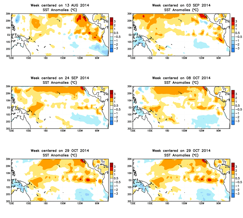
The climate phenomenon known as El Niño, which can alter weather patterns around the globe, still isn’t here. Nine months and counting . . .
And there’s the possibility that it might not form at all, which should not come as a surprise given the tease it’s been. Consider:
March: The first watch was issued, with a 50 percent chance it would arrive by fall
April: Chances held steady at 50 percent
May: The odds increased to 65 percent
June: The forecast said 80 percent, or a 4-out-of-5 chance El Nino would form
July: Still strong at 80 percent
August: Down to 65 percent
September: Still in the 60-65 percent range
October: No change
November: The odds lowered slightly to 58 percent
If you think it’s been aggravating to follow this roller coaster ride, just be thankful you’re not one of the forecasters.
“This has been a rather frustrating six months,” said Mike Halpert, the acting director of the Climate Prediction Center, which issues the monthly El Niño forecast update with the International Research Institute for Climate and Society at Columbia University.
If you’re not at El Niño obsessive, here’s the skinny on it: It’s a cyclical climate pattern that is best known for the signature warm waters it brings to the eastern tropical Pacific Ocean. (It’s counterpart, La Nina, features colder-than-normal waters there.)
But El Niño isn’t just an ocean phenomenon: Those warmer waters alter the flow of the atmosphere above, which has knock-on effects around the globe. These include, for example: upping the chances of drier conditions in northeastern South America (where drought is already plaguing Brazil); raising the possibility of increased rain in Southern California (also desperately in need of precipitation); and quashing the Atlantic hurricane season (something it seems to have done even though it stubbornly refuses to fully form).
El Niños also tend to raise global temperatures, and 2014 is already on track to be the warmest year on record.
The connection between the ocean and the atmosphere is what has perennially plagued this El Niño and held back forecasters from declaring its arrival each month. But, even though forecasters lowered the probability that El Niño will form for this winter, “it still is over 50 percent,” Halpert told Climate Central. “It’s still the favored solution.”
That said, if the forecasters aren’t seeing more of the telltale atmospheric signals by the time they release the January update, they may drop the El Niño watch altogether, he said.
As Halpert put it: “Enough already . . . either get going or let’s just do away with it.”RELATEDHow Will We Know When El Niño Finally Arrives?
Struggling El Niño Still Shaping Hurricane Activity
Why Do We Care So Much About El Niño?
One of the climate models that forecasters most rely on (because it has better predicted the rises and dips in ocean temperatures so far this year), suggests that temperatures may cool in November — not what’s needed to fuel an El Niño.
So what do forecasters want to see to declare an El Niño? “If the ocean stayed exactly the same way and we started to see changes in the winds” in the characteristic El Niño pattern, and models suggested that both of those factors were going to persist for several months, “I’d say that’s probably what it would take for us to declare,” Halpert said.
If the El Niño does form before the end of the year, it would be an atypical, but not unheard of, late start. But that classification is based on just 60 years of data, not enough time to see all the different types of El Niños that may have formed over the past few thousand years. And El Niños only happen every three to seven years, so forecasting them is far different than forecasting tomorrow’s rain.
“It’s one of the things that makes it hard to do what we do here,” Halpert said.
And by the time researchers have a robust number of El Niños in their observations, “I don’t think I’m still going to be doing this,” Halpert joked.
Animation of subsurface temperature anomalies in the tropical Pacific Ocean.
Credit: NOAA.

If this El Niño does fizzle out, it raises larger questions for El Niño forecasting. When the CPC and IRI started issuing El Niño watches less than a decade ago, they nailed the first three El Niño and La Nina events that arose.
“When we started it was easy,” Halpert said.
But since then, forecasts have become trickier. The most notable example was the expected El Niño in 2012 that rapidly fizzled out. “It can’t keep not happening,” Halpert said, because otherwise they’re over-forecasting. And two fizzles in a row makes future forecasting decisions tougher.
“Gosh, if it starts to get warm next year, I don’t know what we’re going to do,” Halpert said.
Halpert and his colleagues are hoping, though, that something happens either way within the next month or two, so they can either declare the El Niño, or, let it go.
“That would be a refreshing change,” Halpert said.
You May Also Like:
Voters Weigh In on Fracking, Water Measures
2014 Will Go Down As Hottest In California’s History
UN Climate Report Rings Alarm, Offers Guidance
New Jersey Retreating from Rivers, But Not Coast, After Sandy