News•June 30, 2014
First Tropical Storm Looms, As Does a Wet July 4th

By Brian Kahn
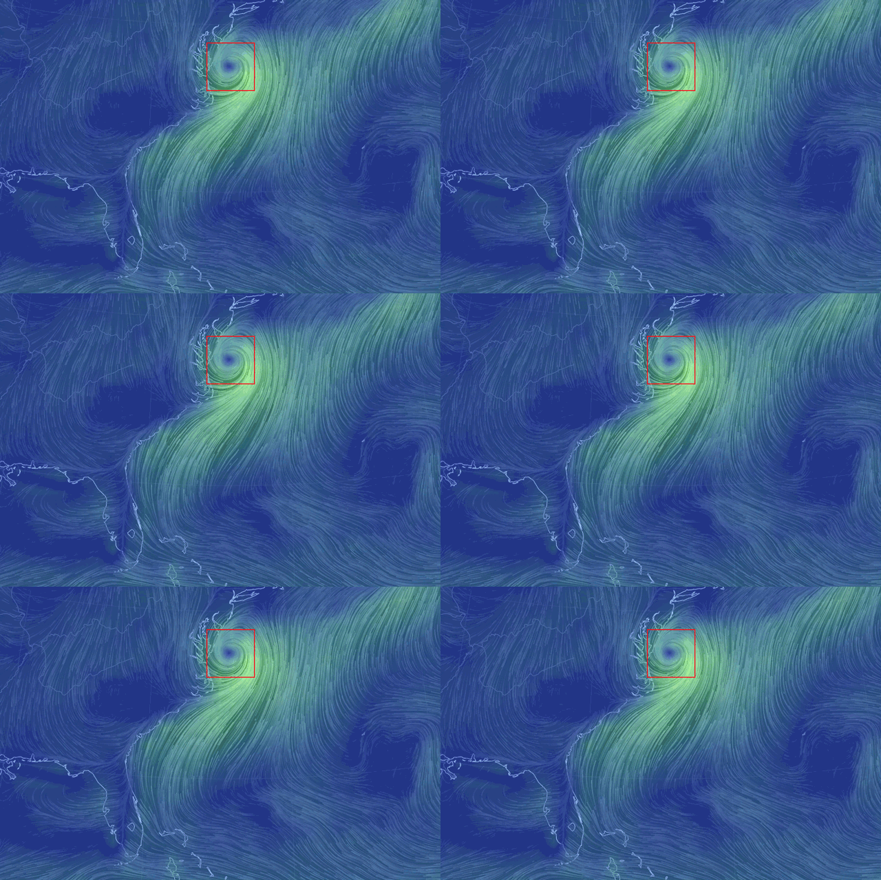
A wind map from the GFS model showing likely Tropical Storm Arthur's location on the afternoon of July 4.
Credit: Earth Wind Map

It might not look like much now, but a messy storm system off the coast of Florida could put a damper on Fourth of July festivities along the East Coast if it pulls itself together to form the first tropical storm of the Atlantic hurricane season.
Right now the system is a loose collection of thunderstorms sitting about 125 miles off Florida’s east coast. But according to forecasters at the National Hurricane Center (NHC) in Miami, it has an 80 percent chance of attaining tropical storm strength within the next 48 hours. The most recent update from NHC said that hurricane hunter aircraft flew a reconnaissance mission to get a better handle on the storm’s strength. They found that it has sustained winds of 30-35 mph, a couple notches below the 39 mph threshold used to define tropical storms.RELATEDEl Nino Expected to Limit 2014 Hurricane Season
Here Are 5 Resources to Track Hurricane Season
The Ocean is Heating Up for Hurricane Season
If it does become a tropical storm, it would be dubbed ‘Arthur.’ For now, though, it’s just “possibArthur” according to The Vane.
There are a number of factors that ultimately favor Arthur’s genesis. One is a stretch of warm, hurricane-friendly water from Florida to North Carolina that will help fuel the convection storms needed to attain tropical storm or hurricane status.
Winds moving through the upper atmosphere are also lining up to aid in tropical storm formation. If those winds are too fast, they can tear apart a storm before it even forms. No such winds are currently blowing over the area or even nearby, giving the storm time to get organized.
Disturbance off Florida coast could become the Atlantic’s first tropical storm of the season. Latest track models: pic.twitter.com/5axvNx0yXm
— BuzzFeed Storm (@BuzzFeedStorm) June 30, 2014
If Tropical Storm Arthur does form, its arrival and potential impacts could create a soggy Fourth of July weekend for millions along the Eastern Seaboard. Most models show the storm moving slowly southwest for the next 24 hours, putting it just off the coast of Florida. However, the storm is then projected to hook north and climb along the East Coast through Saturday.
How close it tracks to the coast will determine whether beachgoers and firework aficionados will get rained out.
Current forecasts indicate that the coastal areas of North Carolina and the Mid-Atlantic could see the heaviest rainfall, picking up as much as 3 inches of precipitation through Sunday. Much of that is forecast to come from the storm. The storm could also bring rain and high surf to New York by the weekend.
A precipitation forecast through Sunday, July 6. Much of the precipitation for coastal areas on the East Coast is due to possible Tropical Storm Arthur.
Credit: NOAA

Hurricane season officially started on June 1. Though it might feel like a month is a long time to pass before the first tropical storm forms, it’s actually right on schedule. On average, the first named tropical storm of the season forms on July 9. And the first hurricane usually occurs on August 10, that according to NHC data from 1966-2009. So this year could be ever-so-slightly ahead of schedule if Arthur forms sometime this week.
The National Oceanic and Atmospheric Administration is forecasting a near- to slightly below-average hurricane season this year. That’s due in part to the likely rise of El Niño, which creates those wind patterns that can tear apart a storm or prevent one from forming.
You May Also Like
Study Digs Deep on Shale Gas Wells, Methane Leaks
Basis for EPA Clean Power Plan Cuts a ‘Mystery’
New CO2 Milestone: 3 Months Above 400 PPM
Map Shows When Summer Heat Peaks in Your Town